


Solution

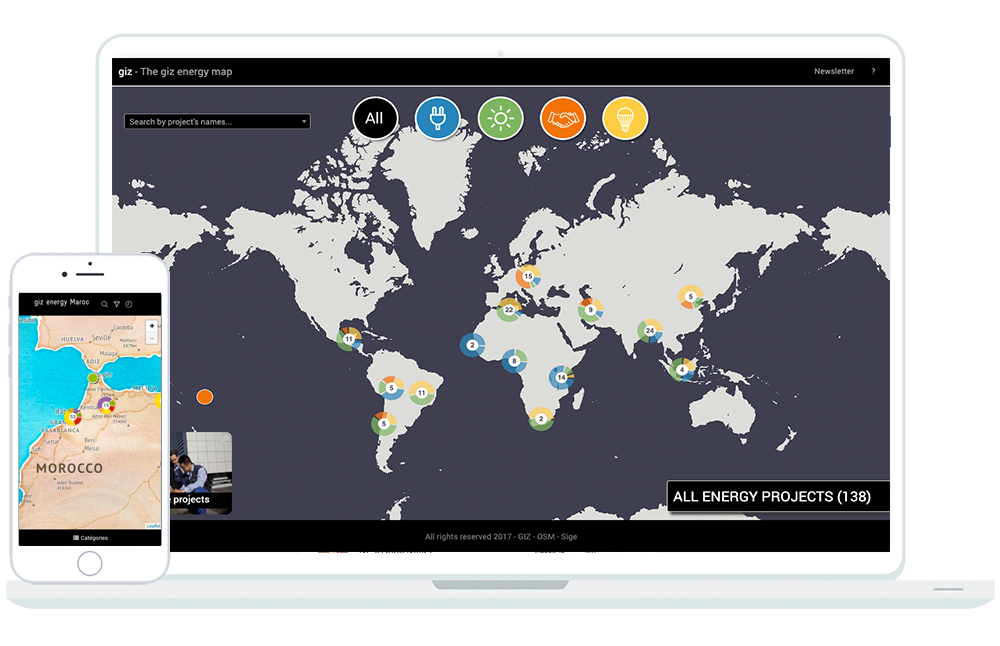
Interactive map
Presents your geodata seamlessly across a variety of basemaps.

Search and filter
Allow users to quickly access the information they are looking for.

Personalized datasheets
Illustrate and highlight your data associated with the objects on the map.
Cartotarget’s roadmap is written by its users.
Please propose and vote for next implemented features Here !
Testimonials
Cartotarget has allowed the Toubkal National Park website to offer its users a more modern, more innovative map, which takes out clichés of classic maps. In addition, its attractive, playful design and ease of use make it a product that really makes you want to discover the Toubkal National Park.
Soraya MOKHTARI,
Director of Toubkal National Park
The EU Delegation to Morocco wanted to develop this interactive map in order to have a modern tool to present, to a wide audience, spatially and in a summary way, the actions of its cooperation on Moroccan territory.
Virginie COUSTET,
Head of Communication for the European Union delegation in Morocco
Features


They trusted us


